
|
|
|
No trackage exists on this line between Church Street in Fenwick and Coyle Yard in Welland.

The TH&B (Toronto Hamilton & Buffalo) was part of the Niagara Region an d Haldimand Norfolk County for almost a century, up until I believe 1985. Like its' name, it ran between Toronto and Buffalo, via Hamilton.
Going to Toronto and Buffalo, off it's own Subdivisions, it used to use running rights on the Michigan Central, NYC, Penn Central and Conrail trackage and CN trackage, but not the Caso Subdivision west of Welland yard (Hewitt Road in Wainfleet).
The TH&B also had a rail line to Port Maitland from Smithville, via this Subdivision as a connection. I want to think the TH&B also at one time went to Port Dover, via their TH&B Waterford Subdivision that was abandoned in 1981 north of Brantford, due to a derailment or washout.
In the Welland on Riverside Drive, the TH&B had a yard named TH&B Coyle Yard. This yard ran between throat tracks to the yard on the south side of the Welland River, on the north side of Riverside Drive and crossing Riverside Drive into a large yard that ran up in behind what later became Vesuvius (formerly Premier Refractories and CE Refractories.
Coyle Yard I am guessing had at least 15 long tracks running a good 1/4 mile to 1.2 mile in length.
Coyle Yard had 2 connections to other railways. First was to the Michigan Central/NYC/Penn Central at the south end of the yard. After all of the tracks led down to I believe a single track, it then passed under (after 1959 a bridge on Prince Charles Drive), then connected into the eastbound main of the other railways' trackage.
The other connection was to the NS&T beside present Vesuvius. This yard I was told was put in became the NS&T didn't want to interchange with I think was Grand Trunk, so they interchanged with TH&B.
TH&B Coyle Yard was closed six months ahead of time in February 1972 after a train derailment near Poth Street near Fenwick. The TH&B was already in the works with the Penn Central to build a yard off of Riverside Drive on Oreilly's Road.
Trackage of the TH&B Welland Subdivision was abandoned in February 1972 and built or already was being built from Church Street in Fenwick directly south to the Welland River and across the Welland River and Riverside Drive and through the bush to join in at Hewitt Road. the track was also expanded with additional trackage. This was what is now the CP Hamilton Subdivision and CP yard siding that ran the whole
distance between north and south siding switch Welland.
After the abandonment of the TH&B Coyle yard site, it was quite evident where some things used to be, even in 1996 and 1997 and even 50 years later. You can still see the clearing of the wye, the location of the buildings within the wye, a concrete bridge over a narrow drainage creek and also near Riverside Drive, there is still a concrete structure.
An 18 track yard was built between what is now mile 21 and mile 20.6 of the present CP Hamilton Subdivision. 2 buildings were also built. A MOW building to the west end of the yard compound and a car control building to the east end of the yard.
The car control building was to be shared between Penn Central and TH&B and also was build as a passenger station for Amtrak. Amtrak used the building for a few I think 13 years until they stopped crossing over the Niagara River at Fort Erie.
In 1985, it bcame totally CP yard. It was a MOW office until 1994 when CP Montrose yard in 1994 closed and relocated regular mix freight switching it's new home at CP Welland yard. CP Montrose yard was torn right after.
In 1996 or 1997 I followed the abandoned TH&B Welland Division from TH&B Coyle yard up to Church Street in Fenwick where the former TH&B Welland Subdivision was still in place and unaffected. TH&B ran up as far as Desjardin. TH&B had another Subdivision in Hamilton that went southwest. It was the TH&B Waterford Subdivision that went down through Brantford and south to Waterford and on a bridge over the old Michigan Central,
NYC, Penn Central main line. That main line then became share asset between CN and CP as the Caso Subdivision.
I'm not exactly sure what year it happened when 3 tracks of this Conrail then or CP now Welland yard, but 3 tracks were eliminated from the yard dropping it down to 15 tracks and track 1 at both ends of the yard were made into 2 stub tracks for locomotives or cabooses.
Coming back to that train derailment... In late 2012, a gentleman contacted me who remembers this incident regarding the train derailment.
"It was after supper and I went outside to feed the dog, I heard a noise looked up, and all I saw was a lot of sparks, then very load crash. At the time there was only an open field between me and the westbound
train which derailed maybe 100 feet from Poth Street on North side of tracks. At least one railcar was carrying a white substance (bare spot on Google maps), which I believe was calcium chloride. We had to be evacuated for a few days.
My brother and I and friends on weekends use to jump train at Poth westbound around 2 pm, to play tennis in Fenwick on Church Street, and return around 4 pm to catch eastbound train.
Sometimes if I missed my ride, a man in a jigger would pick me up, that was quite the experience. Brett Rohaly."
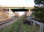
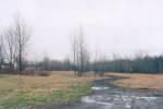
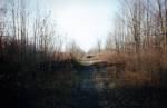
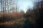
These photos are of the trackage that began at Coyle yard along Riverside Drive, behind Windsor Drive.
253 photos in gallery
Select a mileage to display
| 0 - 5 | 5 - 10 | 10 - 15 | 15 - 20 | 20 - 25 | 25 - 30 | 30 - 35 | 35 - 37 |
 Mile 0.00 Looking East (2013) |
 Mile 0.00 Looking West (2013) |
 Mile 0.00 Looking West (2013) |
 Mile 0.02 Looking East (2013) |
 Mile 0.02 Looking East (2015) |
 Mile 0.02 Looking West (2013) |
 Mile 0.15 Looking Northwest (2013) |
 Mile 0.15 Looking Southeast (2013) |
 Mile 0.38 Looking Northwest (2012) |
 Mile 0.38 Looking Southeast (1996) |
 Mile 0.38 Looking Southeast (2003) |
 Mile 0.38 Looking Southeast (2012) |
 Mile 0.38 Looking Southeast (2013) |
 Mile 0.38 Looking Southeast (2015) |
 Mile 0.40 Looking Northwest (2012) |
 Mile 0.40 Looking Northwest (2013) |
 Mile 0.40 Looking Southeast (2012) |
 Mile 0.40 Looking Southeast (2013) |
 Mile 0.42 Looking Northwest (2013) |
 Mile 0.42 Looking Southeast (2013) |
 Mile 0.42 Looking Southeast (2013) |
 Mile 0.45 Looking Southeast (1996) |
 Mile 0.47 Looking Northwest (2012) |
 Mile 0.47 Looking Southeast (2012) |
 Mile 0.50 Looking Northwest (1996) |
 Mile 0.50 Looking Northwest (1996) |
 Mile 0.50 Looking Northwest (2003) |
 Mile 0.50 Looking Northwest (2012) |
 Mile 0.50 Looking Southeast (2003) |
 Mile 0.50 Looking Southeast (2012) |
 Mile 0.60 |
 Mile 0.60 Looking Southeast (2013) |
 Mile 0.65 Looking Northwest (2003) |
 Mile 0.65 Looking Northwest (2012) |
 Mile 0.65 Looking Northwest (2013) |
 Mile 0.65 Looking Northwest (2013) |
 Mile 0.65 Looking Southeast (2003) |
 Mile 0.65 Looking Southeast (2012) |
 Mile 0.65 Looking Southeast (2013) |
 Mile 0.65 Looking Southeast (2013) |
 Mile 0.80 Looking Northwest (2013) |
 Mile 0.80 Looking Southeast (2013) |
 Mile 0.90 Looking Southeast (2013) |
 Mile 1.10 Looking Northwest (2003) |
 Mile 1.10 Looking Northwest (2012) |
 Mile 1.10 Looking Northwest (2013) |
 Mile 1.10 Looking Southeast (1972) |
 Mile 1.10 Looking Southeast (1996) |
 Mile 1.10 Looking Southeast (1996) |
 Mile 1.10 Looking Southeast (2003) |
 Mile 1.10 Looking Southeast (2012) |
 Mile 1.10 Looking Southeast (2013) |
 Mile 1.50 Looking Northwest (2004) |
 Mile 1.50 Looking Northwest (2005) |
 Mile 1.50 Looking Southeast (2005) |
 Mile 1.50 Looking Southeast (2005) |
 Mile 1.60 Looking Northwest (1996) |
 Mile 1.60 Looking Northwest (2005) |
 Mile 1.60 Looking Northwest (2011) |
 Mile 1.60 Looking Northwest (2013) |
 Mile 1.60 Looking Southeast (1996) |
 Mile 1.60 Looking Southeast (2005) |
 Mile 1.60 Looking Southeast (2011) |
 Mile 1.60 Looking Southeast (2013) |
 Mile 2.00 Looking Northwest (2005) |
 Mile 2.00 Looking Southeast (1996) |
 Mile 2.00 Looking Southeast (2005) |
 Mile 2.10 Looking Northwest (2005) |
 Mile 2.10 Looking Southeast (2005) |
 Mile 2.20 Looking Northwest (1996) |
 Mile 2.20 Looking Northwest (1996) |
 Mile 2.20 Looking Northwest (2005) |
 Mile 2.20 Looking Southeast (1996) |
 Mile 2.20 Looking Southeast (2005) |
 Mile 2.50 Looking Northwest (2005) |
 Mile 2.50 Looking Southeast (2005) |
 Mile 2.80 Looking Northwest (2005) |
 Mile 2.80 Looking Southeast (2005) |
 Mile 3.20 Looking Northwest (2005) |
 Mile 3.20 Looking Southeast (2005) |
 Mile 3.70 Looking Northwest (2005) |
 Mile 3.70 Looking Southeast (2005) |
 Mile 3.75 Looking Northwest (1996) |
 Mile 3.75 Looking Northwest (2005) |
 Mile 3.75 Looking Southeast (2005) |
 Mile 4.25 Looking Northwest (2005) |
 Mile 4.25 Looking Southeast (2005) |
 Mile 4.50 Looking Northwest (1996) |
 Mile 4.60 Looking Northwest (2005) |
 Mile 4.60 Looking Southeast (2005) |
Select a mileage to display
| 0 - 5 | 5 - 10 | 10 - 15 | 15 - 20 | 20 - 25 | 25 - 30 | 30 - 35 | 35 - 37 |
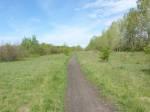
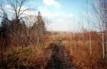
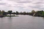
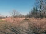
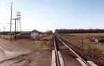
These photos are random photos located between Webber Road in Welland and Church Street in Fenwick.
 (1997) |
 (1997) |
 (1997) |
 (1997) |
 (1997) |
 (1997) |
 (1997) |
 (1997) |
 (1997) |
 (1997) |
 (1997) |
 (1997) |
 (1997) |
 (1997) |
 (1997) |
 (1997) |
 (1997) |
 (1997) |
 (1997) |
 (1997) |
 (1997) |
 (1997) |
 (1997) |
 (1997) |
 (1997) |
 (1997) |
 (2013) |
 Looking Northwest (2013) |
 Looking Northwest (2013) |
 Looking Northwest (2013) |
 Looking North (2013) |
 Looking North (2013) |
 Looking East (2013) |
 Looking East (2013) |
 Looking East (2013) |
 Looking East (2013) |
 Looking Southeast (2013) |
 Looking Southeast (2013) |
 Looking Southeast (2013) |
 Looking Southeast (2013) |
 Looking Southeast (2013) |
 Looking West (2013) |
 Looking West (2013) |
 Looking West (2013) |
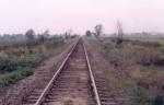
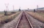
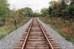
These photos are of the present;y day CP Hamilton Subdivision.
 Mile 2.30 Looking East (1999) |
 Mile 2.70 Looking North (2003) |
 Mile 2.90 Looking North (2000) |
 Mile 2.90 Looking South (2000) |
 Mile 3.97 Looking North (2000) |
 Mile 3.97 Looking South (2000) |
 Mile 5.27 Looking North (2001) |
 Mile 5.27 Looking South (2000) |
 Mile 6.48 Looking North (1996) |
 Mile 6.48 Looking South (1996) |
 Mile 7.23 Looking Northwest (2000) |
 Mile 7.23 Looking Southeast (2000) |
 Mile 8.00 Looking Northwest (1999) |
 Mile 8.00 Looking Southeast (1999) |
 Mile 9.70 Looking Northwest (1999) |
 Mile 9.70 Looking Southeast (1999) |
 Mile 11.50 Looking Northwest (2000) |
 Mile 11.50 Looking Southeast (2000) |
 Mile 12.40 Looking Northwest (2000) |
 Mile 12.40 Looking Southeast (2000) |
 Mile 13.61 Looking Northwest (2000) |
 Mile 13.61 Looking Southeast (2000) |
 Mile 14.28 Looking Northwest (2000) |
 Mile 14.28 Looking Southeast (2000) |
 Mile 15.13 Looking Northwest (2000) |
 Mile 15.13 Looking Southeast (2000) |
 Mile 16.90 Looking Northwest (2000) |
 Mile 16.90 Looking Southeast (2000) |
 Mile 17.47 Looking Northwest (1999) |
 Mile 17.47 Looking Southeast (1999) |
 Mile 20.07 Looking Northwest (1999) |
 Mile 20.07 Looking Southeast (1999) |
 Mile 22.87 Looking Northwest (1999) |
 Mile 22.87 Looking Southeast (1999) |
 Mile 25.05 Looking Northwest (1999) |
 Mile 25.05 Looking Southeast (1999) |
 Mile 25.76 Looking Northwest (1999) |
 Mile 25.76 Looking Southeast (1999) |
 Mile 26.92 Looking Northwest (1997) |
 Mile 26.92 Looking Northwest (2007) |
 Mile 26.92 Looking Southeast (1997) |
 Mile 26.92 Looking Southeast (2007) |
 Mile 30.67 Looking Northwest (1999) |
 Mile 30.67 Looking Southeast (1999) |
 Mile 33.21 Looking Southeast (1999) |
 Mile 35.26 Looking Southeast (1999) |
 Mile 36.63 Looking Northwest (2001) |
 Mile 36.63 Looking Southeast (2001) |
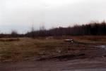
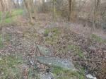
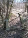
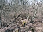
These photos are of remnants of some stone items still situated inside the old wye near the east end of the old wye, behind Vesuvius.
The wye let over to the old NS&T Welland Division, which there is a 3 track yard beside the Vesuveus plant.
The items I found were the followeding. A small concreate bridge, a well and another well with climbing posts inside, plus a steel frame of some kind, which I was led to believe it was the base of an old NS&T Trolley car. But that part, I am not exactly sure of.
Regarding the steel frame aparatus, Ifound it in 1997 and it had wood 4x4 beams on it. But don't see them now... Photos are randomly shown in this batch.
30 photos in gallery
(2013) |
 (2013) |
 (2013) |
 (2013) |
 (2013) |
 (2013) |
 (2013) |
 (2013) |
 (2013) |
 (2013) |
 (2013) |
 (2013) |
 (2013) |
 (2013) |
 (2013) |
 (2013) |
 (2013) |
 (2013) |
 (2013) |
 (2013) |
 (2013) |
 (2013) |
 (2013) |
 (2013) |
 (2013) |
 (2013) |
 Looking North (2013) |
 Looking North (2013) |
 Looking West (2013) |
 Looking West (2013) |
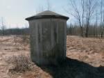
I don't usually place building phoots on my subdivision photo pages, but this one I have decided to place here.
This building was once a communications building, during the years when Coyle yard was still in use, up until 1972.
It is located a few hundred yards east off of Riverside Drive, at Coyle yard, on the east side of what was the former yard.
The switch off of the old NYC main line to the TH&B Welland Subdivision was located about 50 feet east of the Prince Charles Drive overpass.
5 photos in gallery
 (2013) |
 (2013) |
 (2013) |
 (2013) |
 (2013) |
These photos are of the north leg of the wye located in behind Vesuvius in Welland, that led over to the NS&T Welland Division.
6 photos in gallery
Looking Northwest (2013) |
Looking Southeast (2013) |
Looking Southeast (2013) |
Looking Southeast (2013) |
 Looking West (2013) |
 Looking Northwest (2013) |
These photos are of the South leg of the wye located in behind Vesuvius in Welland, that led over to the NS&T Welland Division.
10 photos in gallery
Looking Northwest (2013) |
Looking Southeast (2013) |
 Looking Northeast (2013) |
 Looking Northeast (2013) |
 Looking Northwest (2013) |
 Looking Southeast (2013) |
 Looking Northeast (2013) |
 Looking Southeast (2013) |
 Looking Northeast (2013) |
 Looking Southwest (2013) |
These photos are taken of the point on the wye where the north and south legs meet behind Vesuvius. Looking east, the track continued to where the TR West Welland Spur uard next to Vesuvius is located.
4 photos in gallery
Looking East (2013) |
Looking East (2013) |
Looking West (2013) |
 Looking West (2013) |
These photos are taken of the track that runs between the two legs of the wye but photographed from the north legs looking south on that old track that led over towards the south leg.
4 photos in gallery
Looking Southeast (2013) |
Looking Southeast (2013) |
 Looking Southeast (2013) |
 Looking Southeast (2013) |
These photos are taken of the point on the wye where the north and south legs meet behind Vesuvius. Looking east, the track continued to where the TR West Welland Spur uard next to Vesuvius is located.
4 photos in gallery
Looking East (2013) |
Looking East (2013) |
Looking West (2013) |
Looking West (2013) |
These photos are taken of where the old roundhouse was once located. It was located just north of the wye.
3 photos in gallery
Looking Northwest (2013) |
Looking North (2013) |
Looking West (2013) |
These photos are taken on the north side of the ROW at about mile 0.1, just west of the Prince Charles Drive, west of where the NS&T Welland Diuision diamond was once located. They were used to support metal piping.
4 photos in gallery
Looking North (2013) |
Looking East (2013) |
Looking East (2013) |
Looking West (2013) |
